Earth possesses a remarkably well-hidden geological history. While geologists estimate that hundreds of impact structures scarred our planet over billions of years, only about 200 have been officially confirmed and documented. Now, that exclusive list is growing by one major addition, thanks to an amateur astronomer whose casual search for a remote camping spot in the Canadian wilderness uncovered a massive, previously unrecognized impact crater.
The extraordinary find, located in the rugged terrain of Quebec, highlights the vital role that keen-eyed amateurs and citizen scientists can play in modern geological and astronomical research. What began as a personal travel itinerary transformed into a significant scientific breakthrough, drawing planetary geologists into one of the most punishing and remote field expeditions in recent memory.
A Strange Circle on Satellite Maps
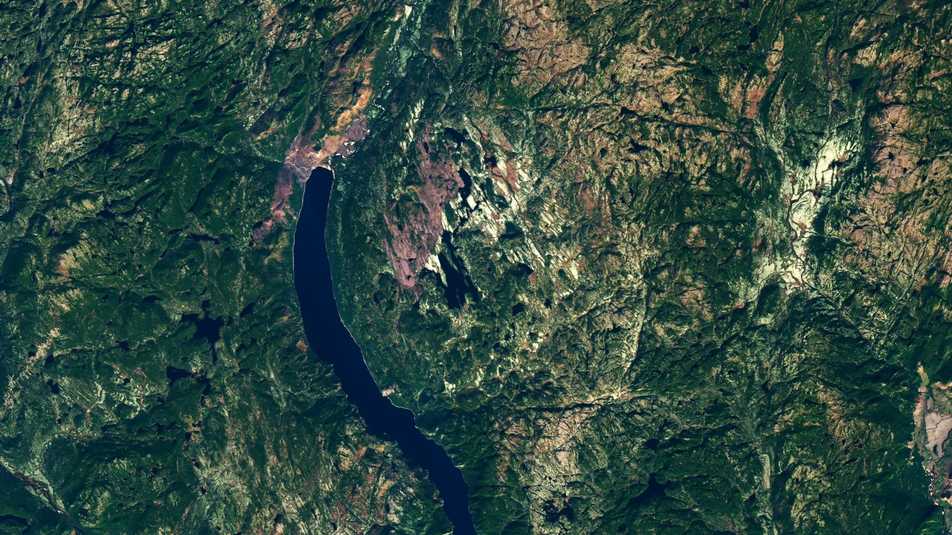
The discovery dates back to 2024, when amateur astronomer Joël Lapointe was preparing for a wilderness excursion into the remote Côte-Nord region of Quebec. Like many modern outdoor enthusiasts, Lapointe turned to online satellite imagery to scout the landscape, trace waterways, and identify potential camping locations.
While scanning the maps, a distinct and peculiar circular feature near Lake Marsal caught his attention. The unusual depression stood out sharply against the surrounding topography, prompting Lapointe to wonder whether the circular basin could have been formed by an ancient extraterrestrial impact rather than standard terrestrial processes. Recognizing the potential significance of his observation, he took the initiative to reach out to geological specialists across Europe and North America to share his findings.
Lapointe’s inquiry proved to be the catalyst for a much larger scientific investigation. His outreach prompted a group of French researchers to analyze the lake area more closely using remote sensing and geological data. At a 2024 meeting of the Meteoritical Society, the researchers formally identified the region as the center of a potential impact structure—which would become the 11th known impact site in the province of Quebec.
The intriguing possibility eventually crossed the desk of Gordon Osinski, a prominent planetary geologist at Western University who also serves as the director of the Impact Earth database, a comprehensive global catalog of confirmed impact structures. While Osinski was initially skeptical, as satellite anomalies can frequently be explained by terrestrial geology such as glacial activity, ancient volcanic vents, or erosion patterns, the feature was compelling enough to warrant a closer look. Driven by scientific curiosity, Osinski began organizing a remote expedition to inspect the isolated location firsthand, setting a plan in motion for October 2025.
A Difficult Journey Into the Quebec Wilderness
Confirming a crater deep in the Canadian Shield is rarely simple, but reaching the Lake Marsal site proved exceptionally challenging almost immediately. Osinski and his team of researchers began their journey by flying into the remote area via floatplane. However, the rugged geography and shallow waters prevented the aircraft from making a clean landing near the shore. To reach land, the scientists had to disembark and wade through 50 meters—approximately 165 feet—of frigid, murky water while carrying their essential field equipment and supplies.
Once the team finally hauled themselves onto the bank, the environmental conditions offered no relief. The landscape was defined by an unforgiving mix of rugged terrain and swampy ground, heavily populated by swarms of biting insects and choked with dense vegetation. Osinski, a seasoned field researcher whose career has taken him across difficult terrains on six distinct continents, described the local flora as "deep, twisty, gnarly vegetation." He candidly noted that despite his extensive global experience, the Quebec site ranked firmly among the most punishing and difficult working environments he had ever encountered.
The scientific stakes were high, particularly because previous geological surveys of the area had interpreted the local breccia rocks—fragmented rock cemented together in a fine-grained matrix—through an entirely different lens. Earlier mapping efforts had categorized the formations as evidence of a funnel-shaped volcanic structure known as a diatreme. A diatreme typically forms deep underground when explosive subterranean gas and magma eruptions punch a vertical pipe-like conduit upward toward the surface, filling it with shattered rock fragments.
For the initial hours of the expedition, the terrain and the historical geological data seemed to suggest a volcanic origin. However, by the second day of fieldwork, Osinski and his colleagues began uncovering physical clues that pointed decisively away from volcanism and toward an entirely different violent origin story.
Shatter Cones Reveal an Ancient Impact
The turning point of the expedition came when researchers began unearthing shatter cones embedded within numerous rock outcrops across the site. Shatter cones are rare, distinct geological structures featuring unique striated, cone-shaped fracture patterns. They form exclusively under the unimaginable shock pressures produced by hypervelocity impacts, such as a massive meteorite collision or an atomic blast. The presence of these formations provided undeniable, compelling evidence that the circular feature was not volcanic at all, but rather the scar of an ancient cosmic collision.
"It’s the only unequivocal evidence of an impact event that you can see in the field with the naked eye," Osinski explained, emphasizing the diagnostic value of the finds.
The celestial object responsible for the cataclysmic event possessed staggering energy, powerful enough to deform the Earth’s crust into a complex crater structure measuring approximately 25 kilometers, or about 16 miles, across. Field observations revealed that the massive site features a classic central uplift—where the rebound of compressed rock creates an elevated region at the crater’s core—alongside dramatic, high cliffs displaying striking columnar jointing caused by the rapid cooling of thermally altered rock.
To contextualize the scale of the event, Osinski noted that if an impact of identical magnitude were to occur in modern-day Quebec, the consequences would be catastrophic. The collision would trigger regional devastation on a scale capable of wiping out major population centers and injecting enough material into the atmosphere to cause severe global climate impacts.
A Crater About 390 Million Years Old
Subsequent laboratory analysis of the rock samples collected during the grueling expedition provided a clearer picture of the timeline. Researchers estimate that the crater formed roughly 390 million years ago, placing the cataclysm during the middle Devonian period. This places the impact roughly 100 million years before a major spike in the frequency of cratering events on Earth—a period that other researchers have suggested may be linked to catastrophic collisions and breakups within the main asteroid belt.
Following respectful consultations with the Innu Council of Ekuanitshit, the scientific team has chosen to refer to the newly discovered feature as Uhackatik. While the research team considers the impact origin essentially confirmed by the field data, formal scientific recognition is anticipated to be finalized when a dedicated committee of the Meteoritical Society convenes for its next scheduled meeting.
With a diameter of 25 kilometers, Uhackatik stands out in the geological record as the largest impact crater discovered anywhere on Earth since the identification of the 31-kilometer Hiawatha structure beneath the ice sheets of Greenland in 2018.
Too Remote for Astronaut Training
Given Osinski’s extensive background in planetary science, including his role as a member of NASA’s first Artemis Geology Team where he helps train astronauts to interpret geological formations in the field, questions naturally arose regarding whether Uhackatik could serve as a future training ground for lunar explorers.
Osinski dismissed the idea, explaining that the extreme isolation and logistical hurdles of the site make it entirely impractical for training operations. Instead, he pointed to a younger and significantly more accessible impact structure located further east in Labrador: Kameshtashtan, also known as Mistastin Lake. That site, featuring much easier access for field teams, has already been utilized successfully in the past to train astronauts in geological reconnaissance.
An Amateur Observation Leads to a Major Discovery
For Joël Lapointe, the journey from looking at a computer screen in 2024 to being recognized as the catalyst for a major geological discovery has been nothing short of surreal. He told CityNews that he was "over the Moon" when researchers finally confirmed that the mysterious circular depression he spotted on the map was indeed a genuine meteorite impact crater.
Lapointe hopes his experience inspires others to trust their curiosity, regardless of their formal professional background. "I encourage everyone to not ignore intuition or an observation, even if it isn’t part of your field of expertise," he shared with another media outlet.
For members of the public inspired by Lapointe’s discovery, numerous avenues exist to contribute to real-world scientific research through ongoing citizen science initiatives. Programs hosted by space agencies and research institutions offer volunteers the chance to aid in cosmic discoveries.
Projects like NASA’s Daily Minor Planet allow everyday participants to help comb through astronomical data in search of uncharted asteroids and comets that could pose future threats to Earth. Similarly, initiatives like Impact Flash invite volunteers to examine dark regions of the lunar surface for fleeting flashes of light produced by meteoroid strikes against the Moon, while the Exoasteroids project empowers citizen scientists to search for evidence of circumstellar debris disks and planetary systems beyond our own Solar System.