Skip to content
Breaking News
  • From ERP Systems to AI Strategy: Inside Aakansha Bhalotia’s 13-Year Tech Journey at Precisely
  • Understanding Thematic Mapping: How Spatial Data Visualization Reshapes Modern Geographic Analysis and Decision-Making
  • GeoHound Chrome Extension Launches with Automated Web Map Service Detection and Built-In Spatial Workbench
Thursday, October 22, 2026
Edition: U.S. International Login

Hack The Map

Month: October 2026

Transportation and Mobility Tech

Comprehensive New Study Evaluates Top-Rated Mobility Equipment and Highlights Leading Wheelchair Models on the Market

October 14, 2026 Dwi Wanna
Wheelchairs remain one of the most widely utilized forms of medical equipment globally, serving an indispensable role in enhancing mobility…
Data Visualization and Infographics

Breaking Through the Clutter: How a Custom Client Workshop Transformed Complex Staffing Data into an Actionable Story

October 14, 2026 Neng Nana
When facing an expected staffing shortfall, bringing the issue to leadership’s attention is a critical first step. However, a forecast…
Location Intelligence and Spatial Analytics

The Data Bottleneck: Why Enterprise AI is Stalling and What Leaders are Doing to Fix It

October 14, 2026 Muslim
As artificial intelligence rapidly transitions from experimental proofs of concept into heavy enterprise production, organizations are discovering a harsh reality:…
Drone Mapping and Aerial Photography

Equipping Drones with Insect Biology: Japanese Researchers Develop Hydrogel to Keep Bug Antennae Functioning in Flight

October 14, 2026 Lina Irawan
In a significant step forward for the field of biohybrid robotics, a collaborative team of researchers from Shinshu University and…
Geography and Earth Science

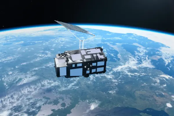
Europe’s New Sentinel-3C Satellite Delivers Spectacular First Earth Images and Precise Climate Data

October 14, 2026 Lina Hope
Just two weeks after successfully reaching orbit, Europe’s newly launched Copernicus Sentinel-3C satellite has delivered its first breathtaking images of…
Urban Planning and Smart Cities

HUD Pursues Sweeping Policy Shifts and Structural Overhauls Under Trump Administration

October 14, 2026 Pevita Pearce
The U.S. Department of Housing and Urban Development has continued to undergo a profound and rapid transformation under the Trump…
Geopolitics and Map News

Symbiosis International Annual Dinner: Dr Ramakrishnan Raman Emphasizes AI Readiness, Global Diplomacy, and Future-Ready Education in New Delhi

October 14, 2026 Basiran
NEW DELHI — In an era defined by rapid technological disruption and shifting global dynamics, the role of higher education…
Environmental and Climate Mapping

Interactive: Tracking negotiating texts at the COP17 biodiversity summit

October 14, 2026 Pevita Pearce
Beginning on 19 October and running through 30 October, representatives from 196 parties will gather to negotiate the precise wording…
Geolocation and Cybersecurity

UK Sanctions Chameleonic Crypto Platform Cryptomus Over Cybercrime and Russian Sanctions Evasion

October 14, 2026 Nana Muazin
The United Kingdom has officially issued sweeping economic sanctions against Cryptomus, a volatile and shifting cryptocurrency platform that cybersecurity experts…
Open Source Geospatial Software

GeoServer Issues Urgent Security Update After August Zero-Day Disclosure and Outlines New AI Vulnerability Policies

October 14, 2026 Evan Lee Salim
The GeoServer project has issued a comprehensive security recap detailing a tumultuous summer of vulnerability disclosures, zero-day exploits, supply chain…

Posts navigation

Older posts
Newer posts

Recent Posts

  • From ERP Systems to AI Strategy: Inside Aakansha Bhalotia’s 13-Year Tech Journey at Precisely
  • Understanding Thematic Mapping: How Spatial Data Visualization Reshapes Modern Geographic Analysis and Decision-Making
  • GeoHound Chrome Extension Launches with Automated Web Map Service Detection and Built-In Spatial Workbench
  • From ERP Systems to AI Strategy: Inside Aakansha Bhalotia’s 13-Year Journey Shaping the Future of Tech
  • Elistair Unveils Tethered Air Module for Parrot ANAFI UKR to Enable Hours of Uninterrupted ISR Missions

Recent Comments

No comments to show.

Archives

  • October 2026
  • September 2026
  • August 2026

Categories

  • Data Visualization and Infographics
  • Disaster Response and Humanitarian Mapping
  • Drone Mapping and Aerial Photography
  • Environmental and Climate Mapping
  • Geography and Earth Science
  • Geolocation and Cybersecurity
  • Geopolitics and Map News
  • GIS and Spatial Technology
  • Location Intelligence and Spatial Analytics
  • Open Data and Civic Tech
  • Open Source Geospatial Software
  • OpenStreetMap and Community Mapping
  • Remote Sensing and Satellite Imagery
  • Transportation and Mobility Tech
  • Travel Hacking and Digital Nomad
  • Urban Planning and Smart Cities
  • Web Mapping and Cartography

© 2026 Hack The Map. All rights reserved.

Theme: The Original by Rifan Muazin.