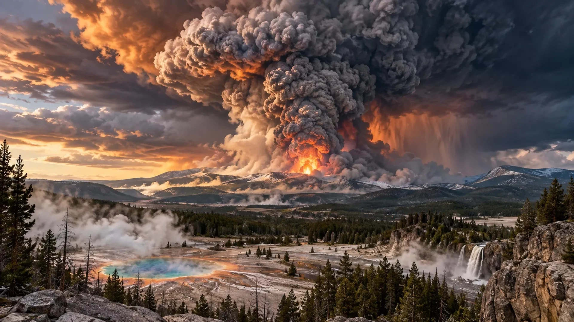
Around 631,000 years ago—a mere geological blink of an eye—a profound catastrophe unfolded in what is now north-western Wyoming. During a series of immense volcanic eruptions, life within hundreds of kilometers of the blasts was entirely shattered. Ash dispersed across much of North America, and the far-reaching climatic effects were felt worldwide. This was a super-eruption of the massive volcanic system located in modern-day Yellowstone National Park.
Despite the monumental scale of the event, no known human witnessed the cataclysm. As far as archaeological evidence indicates, early humans had not yet reached the North American continent. Across oceans, however, early human populations may have looked up in wonder at hazier skies and unusually vivid sunsets. Volcanic particles circulating in the upper atmosphere cooled their climate and likely disrupted local weather patterns and daily survival. Whether they noted these environmental shifts or connected them to a distant, unseen event remains entirely unknowable.
Today, however, modern global civilization would certainly notice. Science has firmly established that a super-eruption on this scale would pose an existential threat to society as we know it. To understand the gravity of this threat, disaster and volcano experts have mapped out a detailed scientific thought experiment exploring what humanity might actually experience if Yellowstone were to erupt today. The hypothesis is grounded in decades of rigorous volcanological research and observations of how nations have managed compounding modern crises.
T-2 months
Shortly after 6 a.m., an analyst at the University of Utah Seismograph Stations notices a series of sharp spikes interrupting the usually quiet, wavy lines recorded by Yellowstone’s earthquake monitors. The measurements represent a cluster of tremors detected beneath the park overnight. The scientist pauses, takes a deep breath, and recognizes that these observations deviate sharply from Yellowstone’s standard baseline behavior.
The public often imagines Yellowstone as a dormant "supervolcano." While it may be sleeping, its geological processes never truly rest. A sophisticated array of instruments monitors its constant activity. A dense network of seismometers records regional earthquakes around the clock, while data feeds continuously from GPS stations, strainmeters that measure the changing shape of the Earth’s crust, and sensors positioned within active geyser basins. Satellite observations, gas sampling, and regular field surveys provide critical supplementary data.
Volcanologists analyze the frequency, location, depth, and magnitude of these earthquakes. Earthquake swarms warrant particular attention, especially when they migrate through the solid outermost rocky shell of the crust or become progressively shallower. Such patterns frequently indicate that magma or pressurized, mineral-rich hydrothermal fluids are forcing their way upward.
On this morning, the analyst is initially relieved to discover that most of the unusual tremors are tiny—far too weak to be felt at the surface. Yet together, they form a tightly concentrated swarm. Checking the signals against neighboring seismometers, the analyst contacts colleagues at partner organizations within the Yellowstone Volcano Observatory (YVO) to initiate standard response protocols.
The team deduces that instruments overnight recorded a tightening cluster of earthquakes beneath Yellowstone’s vast caldera, which measures roughly 55 to 70 kilometers across. Yellowstone experiences thousands of earthquakes every year, and swarms are common, but this specific sequence appears to be migrating slightly upward. Nevertheless, an earthquake swarm alone does not mean Yellowstone is preparing to erupt, nor do isolated instances of ground deformation, changing surface temperatures, or shifting gas emissions. Scientists become genuinely concerned only when multiple indicators escalate simultaneously. For now, the team decides to monitor the situation closely.
T-1 month
Four weeks later, the earthquake swarm has continued its upward migration. New seismic events are materializing along a narrow zone directly beneath the caldera. The analyst, now tracking the data with mounting urgency, notes that GPS stations positioned above the swarm have begun moving apart. Strain measurements have escalated, and satellite radar reveals the underlying cause: a broad, accelerating uplift of the ground surface.
Together, these observations are consistent with fresh magma forcing its way into the Earth’s crust—a phenomenon documented in volcanic regions such as Hawai’i prior to eruptions. Reassuringly for YVO staff, Yellowstone has produced similarly alarming combinations of signals in the past without culminating in an eruption. Between 2013 and 2014, parts of the caldera rose at rates exceeding 15 centimeters per year alongside increased seismic activity, culminating in a magnitude 4.8 earthquake—the largest recorded at Yellowstone since 1975. Shortly after, the uplift transitioned to subsidence as scientists concluded the episode was driven by hydrothermal fluid movements rather than ascending magma.
Mindful of the imperative to keep the public informed without inciting panic, the YVO responds with calculated caution. A duty scientist is assigned to continuous data assessment. Additional temporary seismometers and GPS units are deployed to gather high-resolution data, while gas and water samples are collected with greater frequency.
The YVO initiates close coordination with the National Park Service and emergency management authorities, reviewing evacuation routes, public communication strategies, and potential road closures. To err on the side of caution, Yellowstone’s Volcano Alert Level is raised from "normal" to "advisory," signaling that unrest has surpassed established background levels.
As these developments compound, scientists privately game out the potential impacts of a major eruption. The media takes an intense interest, though volcanologists are acutely aware of how quickly scientific uncertainties can devolve into public disputes. Privately, researchers debate differing interpretations while committing to transparent, regular public updates through media briefings and official channels. As volcanic activity accelerates, high-level decision-makers are alerted that the crisis could escalate into a historic catastrophe, with the probability of an eruption within three months climbing from an initial 6-9% to 21-27%.
Given the inherent uncertainties, politicians hold off on specific mandatory declarations, but the Federal Emergency Management Agency (FEMA) quietly begins drafting large-scale evacuation frameworks. Over the ensuing fortnight, the unrest escalates dramatically. Earthquakes grow more frequent and shallower. Long-period seismicity and sustained volcanic tremors indicate that magma and pressurized fluids are actively fracturing the subsurface rock.
Ground uplift accelerates, with GPS stations shifting by centimeters over mere days. Geyser activity becomes erratic; even Old Faithful loses its legendary regularity. Meanwhile, gas measurements and spring water chemistry reflect a surging influx of carbon dioxide and sulfurous gases into the hydrothermal system. The convergence of shallow earthquakes, rapid uplift, and gas anomalies points decisively toward an ascending body of magma.
T-2 weeks: "It’s gonna blow!"
These compounding observations prompt a joint press conference announcing an estimated 85-92% probability of a cataclysmic eruption within three weeks. The YVO elevates Yellowstone’s warning level to "watch," while the Federal Aviation Administration and the US Geological Survey raise the Aviation Color Code to orange, rerouting commercial aircraft away from the region.
An evacuation zone extending 100 kilometers beyond Yellowstone National Park is formally announced, affecting roughly 200,000 residents and thousands of seasonal visitors. The unfolding crisis instantly dominates traditional and social media channels, drawing skepticism from detractors who claim nothing will happen, alongside conspiracy theories alleging that scientific agencies are manufacturing the crisis for geopolitical gain.
With a super-eruption appearing increasingly imminent, world leaders face a stark choice: collaborate as a global community or resort to fragmented, COVID-style national shuttering. True international cooperation would involve orchestrating massive evacuations across national borders, supported by shared housing, water, food, and infrastructure. While the United States possesses the financial and material resources to manage a resettlement of this magnitude, historical precedent suggests countries may hesitate to accept large numbers of climate and volcano refugees due to resource constraints.

Charities and self-evacuation networks mobilize hastily, but the poorest and most marginalized populations often find themselves with few options, trapped by circumstance or disbelief.
T=0
In an instant, seismic instruments are overwhelmed by an intense burst of shallow earthquakes. Expanding clouds of steam erupt from newly opened ground fractures. The YVO and USGS have no alternative than to elevate warning levels and Aviation Color Codes to red: a dangerous eruption is underway.
The cataclysm does not begin with an instantaneous collapse of the entire caldera. Instead, rising magma intrudes into Yellowstone’s shallow hydrothermal system, rapidly vaporizing immense volumes of water. At atmospheric pressure, water expands in volume roughly 1,700 times when converted to steam. Trapped beneath the surface, this rapid expansion triggers violent phreatomagmatic explosions that hurl superheated steam, mud, and shattered rock kilometers into the atmosphere.
While evacuation zones protect human populations from immediate devastation within the park, regional wildlife, livestock, and vegetation are obliterated. Within four to six kilometers of the initial vents, the landscape is battered by falling debris. Beyond the exclusion zone, onlookers watch an impressive two-kilometer-high plume erupt into the clear morning sky—a spectacle that rapidly expands into a towering hazard.
Hours later, gas-rich magma heated to between 650 and 800 degrees Celsius breaches the fractured surface. As confining pressure drops, dissolved gases expand violently, fragmenting the molten rock into pumice and ash while tearing away enclosing vent walls. This buoyant mixture drives a colossal eruption column 30 to 50 kilometers high into the stratosphere, far above commercial cruise altitudes. The upper reaches of the plume are visible from Denver, some 800 kilometers away.
As expelled volumes mount, scientists confirm the opening stages of a VEI 8 super-eruption—the maximum rating on the volcanic explosivity index. Humanity has not witnessed an event of this magnitude since the eruption of Mount Toba in Indonesia approximately 74,000 years ago.
The immense umbrella cloud does not merely drift with the wind; its initial momentum drives ash outward in all directions for hundreds of kilometers before high-altitude stratospheric winds carry fine particles thousands of kilometers downwind. As eruption columns repeatedly collapse, they generate scorching pyroclastic density currents—superheated, fast-moving avalanches of gas, ash, and rock that surge across the terrain, igniting forests and burying everything in their path.
Casualties mount within and beyond the immediate blast zone. Beyond the direct impact of pyroclastic flows, fatalities occur due to vehicle accidents caused by zero-visibility ashfall, acute respiratory distress, and secondary fires. As the magma chamber empties, sections of the unsupported caldera floor subside, triggering secondary venting and continuous ash production that plunges neighboring states into darkness and disrupts power, water, and communications across at least eight states.
T+3 days
Three days into the cataclysm, much of North America exists in the shadow of Yellowstone. Billings, Montana, faces accumulations of ash exceeding a meter in depth, while Salt Lake City and Boise receive tens of centimeters. Day turns to twilight across southern Canada, the United States, and northern Mexico. Outside, breathing without filtration masks becomes hazardous.
Electrical grids begin failing on a massive scale. Fine, damp ash conducts electricity, short-circuiting power lines and substations while clogging mechanical intakes. As electricity fails, municipal water pumps, sewage treatment plants, heating systems, and telecommunications collapse. Panic buying empties supermarket shelves nationwide as supply chains fracture.
T+2 weeks
Over the following fortnight, the crisis solidifies into a desperate struggle for survival. Continuous ashfall overwhelms drainage infrastructure, collapses roofs under its immense weight, and turns into a dense, obstructive slurry when mixed with rain. Airports across North America remain closed, and freight networks stall. Agricultural losses mount as crops and pastures are buried under toxic deposits.
Surrounding nations declare states of emergency as they manage localized ash fallout while absorbing refugees fleeing the devastated United States. Humanitarian airdrops provide temporary relief, but global stockpiles are severely strained.
T+4 months
Months after the initial blasts, volcanic activity wanes to intermittent explosions, but the hazard persists. Winds continually remobilize dry ash deposits, exacerbating chronic respiratory illnesses and overworking crippled healthcare systems. Agricultural deficits in North America drive global food prices to unprecedented heights, triggering a synchronized international banking, insurance, and economic recession.
Meanwhile, stratospheric sulfur dioxide has formed sulfate aerosols that reflect solar radiation, initiating a multi-year volcanic cooling episode. While climate models suggest global average temperatures will drop by no more than roughly 1.5 degrees Celsius, central North America experiences severe, prolonged cooling anomalies.
T+10 years
A decade after the eruption, global society has adapted to a grueling long-term recovery. Populations lean toward localized agrarian lifestyles, converting recreational spaces into vertical farms and greenhouses. Livestock numbers have plummeted due to feed shortages, replaced largely by insect farming and expanded coastal fishing.
Water security remains precarious. While large-scale treatment technologies exist, supply chains for chemical agents and replacement parts are unreliable, leading to resurgent waterborne diseases such as cholera and malaria in vulnerable regions. Global population estimates decline due to spikes in infant and elderly mortality, while survivors contend with long-term health consequences, including rising rates of silicosis and lung cancer linked to persistent silica dust exposure.
Within the original eruption zone, the landscape slowly stirs back to life. Grasslands and pioneer forests gradually reclaim the gray expanses, and the Earth slowly resets beneath clear skies as atmospheric ash finally settles.
T+1 million years
A million years into the future, an exploratory visitor from a distant technological civilization descends to Earth. Scanning the lush, restored biosphere, the traveler notes a vast, elliptical depression etched into the North American continent—a geological scar left behind by an ancient super-eruption. Reviewing fragmentary planetary archives, the visitor wonders whether this monumental cataclysm coincided with the rise and fall of the planet’s first technological species, or whether they simply missed the disaster by a geological hair’s breadth.