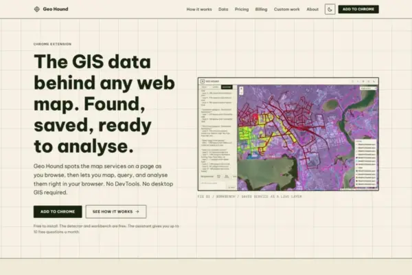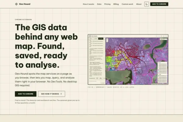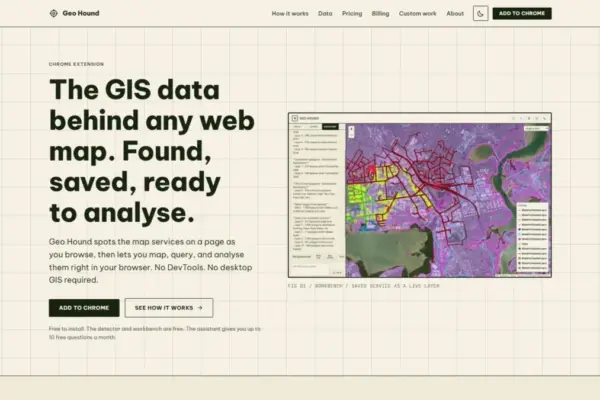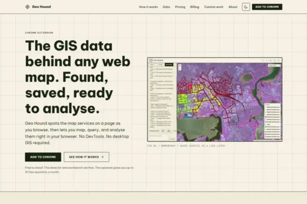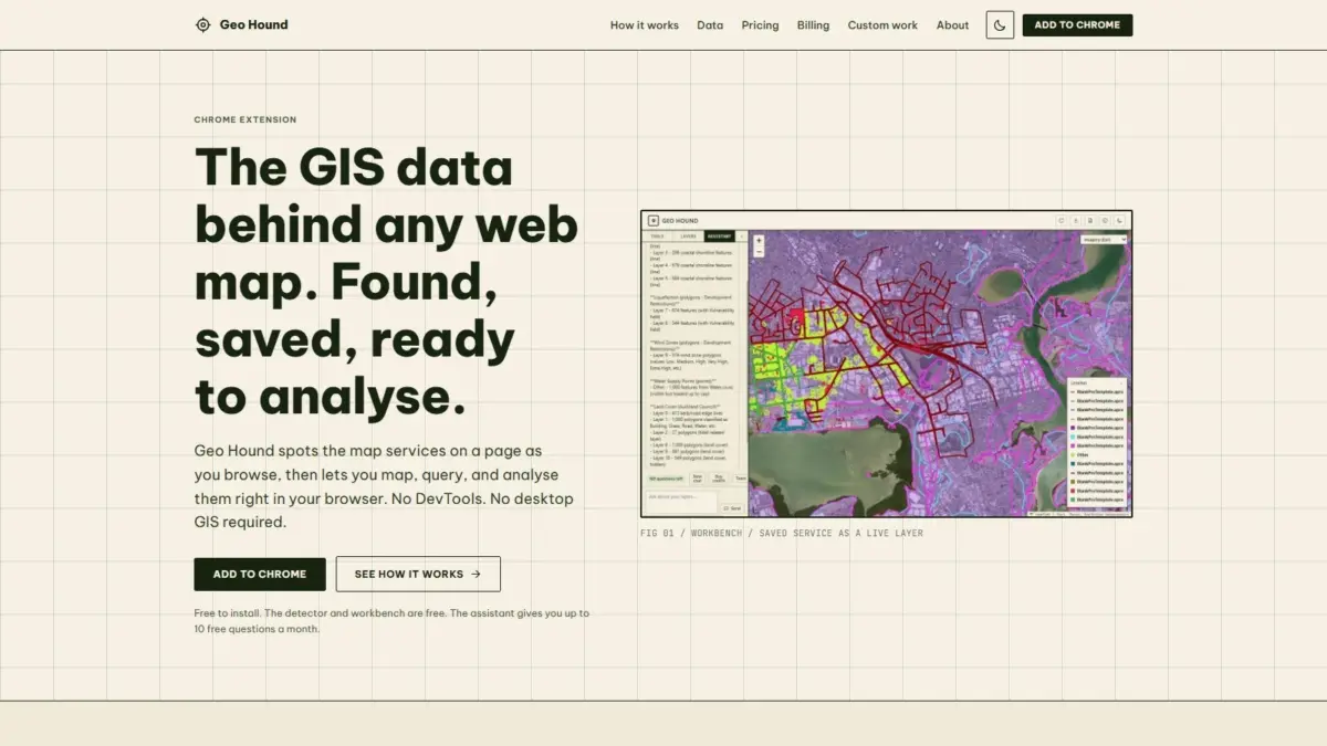
A new browser extension named GeoHound aims to streamline how spatial data is discovered, inspected, and processed across the web by allowing users to detect and manipulate underlying web map layers directly inside Google Chrome. Developed by geospatial specialist Daniel O’Donohue, the tool is designed to eliminate the technical friction traditionally associated with identifying backend map services, offering an integrated browser-based workbench and an artificial intelligence assistant capable of executing spatial analysis tasks using natural language prompts.
Modern web mapping applications rely on an array of server-side spatial services to deliver interactive geographic visual information to end users. When viewing an interactive map on a public portal, news site, or municipal dashboard, the visual map displayed on screen is typically rendered from vector or raster layers hosted on remote servers. Historically, uncovering the precise server endpoints, data structures, and raw geospatial datasets powering those web interfaces required spatial analysts, data journalists, and researchers to engage in a technical process often referred to as "DevTools spelunking."
This manual extraction process typically involves launching browser Developer Tools, monitoring network traffic logs as maps pan and zoom, filtering through hundreds of HTTP requests, and deciphering complex dynamic server request endpoints. Analysts searching for underlying data streams had to inspect individual network calls to identify endpoints associated with server platforms like ArcGIS Server or web services implementing Open Geospatial Consortium standards. Once identified, these links had to be manually tested, verified, and copied into desktop software to inspect the raw data or execute basic geographical operations.
GeoHound redefines this workflow by running passively in the background as users navigate map-heavy websites. The extension automatically identifies the spatial data feeds actively powering any web map in real time, capturing service details without requiring manual intervention or background technical queries. Across its detection engine, GeoHound can recognize 29 distinct types of geospatial data services. Supported protocols and formats include Web Map Service (WMS), Web Feature Service (WFS), various OGC APIs, ArcGIS REST services, raster and vector tile services, and standalone GeoJSON files.
Beyond simply flagging the presence of spatial web services, GeoHound saves discovered layers along with their associated metadata. Metadata preservation is a critical component of spatial data management, as underlying technical details—such as attribute field definitions, layer schemas, coordinate reference systems, bounding boxes, and server service limits—provide necessary context for accurate geographic mapping and analysis. By storing metadata alongside detected spatial endpoints, the tool ensures that users maintain full technical visibility into the provenance and parameters of captured web layers.
Once spatial layers are detected and saved, GeoHound provides a built-in workbench directly within the Chrome interface, allowing users to transition immediately from data discovery to data manipulation. Rather than forcing users to export discovered endpoints into external desktop software packages, the browser-native environment features tools for performing spatial and tabular operations directly on saved layers.
Within the workbench interface, users can perform standard spatial data processing functions, including feature and attribute filtering, spatial buffering around geographic geometries, and tabular or spatial joins to merge separate datasets. Furthermore, processed datasets can be exported directly from the browser environment into standard geographic data formats for downstream applications. This built-in functionality enables rapid data verification, subset creation, and light spatial analytical routines without interrupting the web browsing session.
The ability to perform geographic operations directly within the browser tab addresses a long-standing workflow bottleneck for spatial professionals and researchers. Traditionally, performing simple spatial tasks on web-based datasets—such as creating a geometric buffer around a boundary, filtering features by specific attributes, or exporting a sub-region of a web map layer—required launching resource-intensive desktop Geographic Information System (GIS) suites, such as QGIS or Esri ArcGIS Pro. By moving fundamental layer inspection, filtering, buffering, and export functions directly into the browser, GeoHound reduces dependency on heavy desktop setups for everyday web map investigation tasks.
In addition to manual tools provided in the workbench, GeoHound incorporates an artificial intelligence assistant designed to execute GIS operations through plain English commands. By integrating natural language processing into spatial workflows, the tool allows users to query saved map layers, execute geographic analytical routines, and process spatial attributes without entering programmatic syntax or navigating complex menu structures. Users can instruct the assistant using plain language requests to run spatial tasks on their captured web layers, lowering the technical entry barrier for non-specialist users while expediting analytical routines for experienced GIS professionals.
GeoHound offers its core detection features and browser-based workbench free of charge, providing open access to spatial service discovery and basic browser-based editing capabilities. The natural language AI assistant offers an enhanced interface for executing complex GIS tasks directly on captured layers, expanding the scope of what can be accomplished inside a standard web browser environment.
The extension was created by Daniel O’Donohue, an experienced geospatial specialist known throughout the spatial technology sector as the creator and host of The MapScaping Podcast, a popular media platform dedicated to the geospatial community. Drawing on years of industry experience spent using spatial technologies to analyze real-world geographic complexities, O’Donohue developed GeoHound to address recurring practical challenges faced by mapping professionals, open-data advocates, researchers, data journalists, and software developers who interact with distributed spatial web services daily.
The release of GeoHound reflects broader ongoing trends across the geospatial industry, where spatial data access and processing workflows are increasingly shifting toward web-native architectures and lightweight browser environments. As public sector agencies, research institutions, and private organizations continue to publish spatial datasets through diverse web protocols, tools that automate layer discovery and metadata capture simplify access to information locked behind visual web map interfaces.
By bridging the gap between web map viewing and spatial data analysis, GeoHound allows users to seamlessly intercept background map layers, inspect metadata parameters, execute spatial operations like buffering and joining, and interact with datasets using artificial intelligence—all within the standard Google Chrome browsing interface.