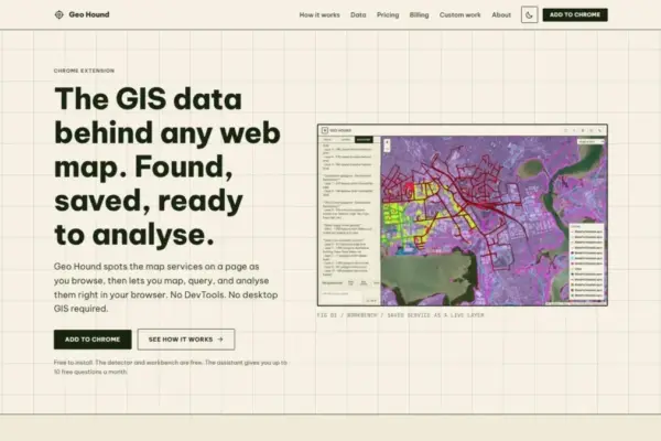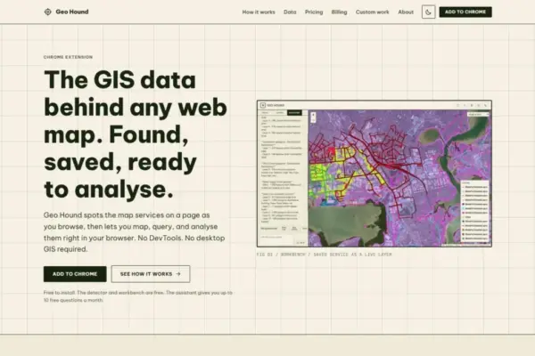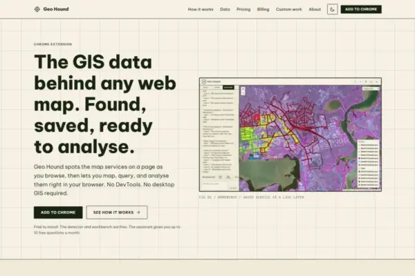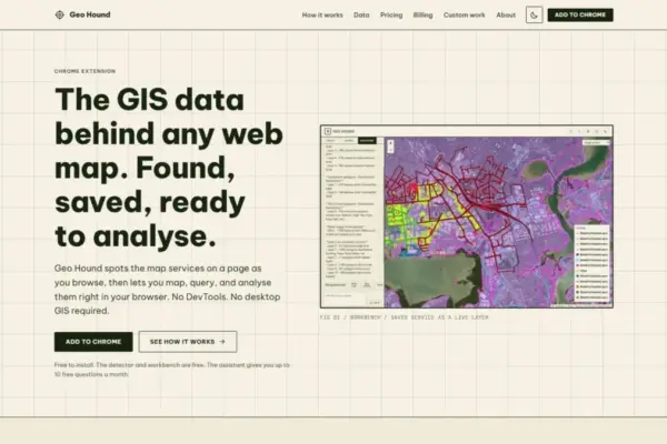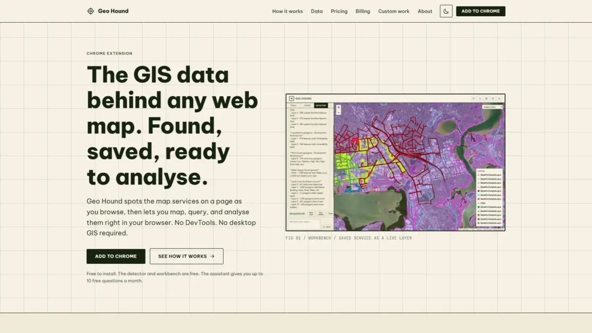
A new browser-based tool named GeoHound has been introduced to streamline how geospatial professionals, researchers, and map enthusiasts discover and interact with spatial data across the web. Developed as an extension for the Google Chrome web browser, GeoHound automatically identifies the underlying spatial data services that power interactive web maps as users navigate standard web pages. Beyond simple identification, the software captures associated metadata and incorporates a built-in workbench environment, allowing users to filter, buffer, join, and export spatial data directly within their browser without requiring specialized desktop mapping software or complex manual technical inspection.
The release addresses a longstanding challenge in web cartography and spatial data acquisition. Modern web maps published across government portals, environmental monitoring sites, municipal planning platforms, and commercial dashboards rely on backend server endpoints to feed geographic data to the user interface. However, identifying where that data originates and gaining access to the raw service layers has historically been an involved process. Users typically had to open browser developer consoles, sift through dense network traffic logs, analyze individual HTTP request headers, and manually construct endpoints—a tedious activity often described within the industry as developer tools spelunking. GeoHound eliminates this friction by operating passively in the background, surfacing map endpoints automatically as web maps load on screen.
The detection engine built into GeoHound supports 29 distinct geographic web service and data types, offering broad compatibility across both open-standard and proprietary web mapping infrastructures. Among the supported formats are foundational Open Geospatial Consortium protocols, including Web Map Services, which deliver pre-rendered map images, and Web Feature Services, which transmit vector geometries and numerical attributes directly to the client. The extension also detects modern OGC APIs designed for contemporary web architectures, as well as widely deployed commercial standards such as Esri ArcGIS REST services, which power thousands of public sector and enterprise spatial portals globally. Additionally, GeoHound detects various tile services—including vector and raster tile endpoints—and standalone spatial file formats like GeoJSON.
A core component of the tool is its ability to capture and preserve metadata alongside detected spatial layers. When an endpoint is discovered, GeoHound saves critical background details about the service, such as spatial reference systems, coordinate specifications, layer definitions, field schemas, and underlying source descriptions. Preserving this metadata ensures that when layers are extracted or analyzed, users retain the spatial context and provenance necessary for accurate mapping and data integration, preventing common errors related to misaligned projections or missing attribute definitions.
Once spatial services are detected and saved, users can interact with them directly inside Chrome using GeoHound’s built-in workbench. The workbench provides an in-browser geographic information system workspace designed to conduct initial analytical tasks and data manipulations without forcing the user to export data into external desktop desktop tools like QGIS or ArcGIS Pro. Within this browser environment, users can apply attribute and spatial filters to refine large datasets down to relevant features, run buffering operations to generate geographic proximity zones around vector boundaries, and execute attribute or spatial joins to merge tabular records with spatial features.
After completing analytical operations within the workbench, users can export the resulting spatial layers into standard file formats for local storage or further downstream applications. This seamless workflow transforms passive web browsing into an active data collection and preliminary analysis process, significantly reducing the setup time usually required to ingest third-party web layers into spatial software pipelines.
In addition to its detection and workbench tools, GeoHound incorporates an artificial intelligence assistant capable of executing spatial analysis tasks through natural language interactions. Rather than navigating complex toolbar menus, configuring parameters manually, or writing custom geometry scripts, users can instruct the AI assistant to perform spatial operations on their saved layers using plain English commands. The assistant translates conversational queries into execution steps within the workbench, enabling users to isolate specific spatial relationships, run geometry operations, and generate analytical derivative datasets dynamically.
The core functionality of GeoHound, including both the automated endpoint detector and the in-browser spatial workbench environment, is provided free of charge to users. The inclusion of the plain-English AI assistant provides an additional layer of accessibility, helping bridge the gap between technical GIS execution and conversational user input for both expert cartographers and non-specialist data analysts.
GeoHound was created by Daniel O’Donohue, a geospatial specialist who is also the voice and creator behind The MapScaping Podcast, a popular media platform dedicated to exploring technologies, trends, and methodologies across the geospatial industry. Drawing on years of experience working with spatial data and discussing sector advancements with developers and industry leaders, O’Donohue designed the tool to eliminate recurring technical bottlenecks in spatial data discovery and make web map services more transparent and accessible to the broader community.
The utility of such a tool spans multiple discipline areas within the spatial ecosystem. Urban planners reviewing municipal development maps can harvest underlying land parcel or zoning layers directly from web portals without requesting raw files from database administrators. Environmental researchers monitoring real-time sensor platforms or land-use dashboards can isolate the underlying vector feeds for offline modeling. Similarly, data journalists and open-source intelligence researchers investigating spatial events can extract map layers embedded in news stories or public dashboards, verify the underlying data source against preserved metadata, and analyze spatial patterns directly in the browser client.
By integrating real-time network layer capture, metadata storage, client-side spatial processing, and natural language AI processing into a single web browser extension, GeoHound represents a shift toward more integrated and accessible web-based spatial data collection workflows. The software allows users to bypass historical software barriers and manual network analysis, providing direct access to the web services that underpin modern digital cartography.