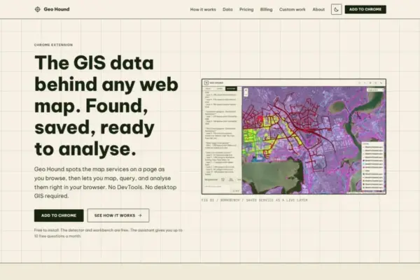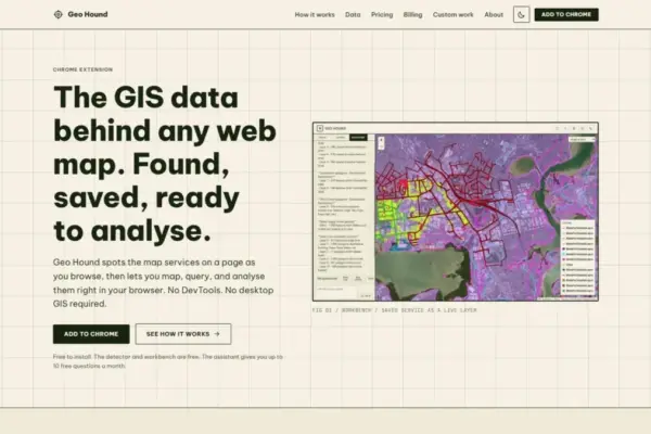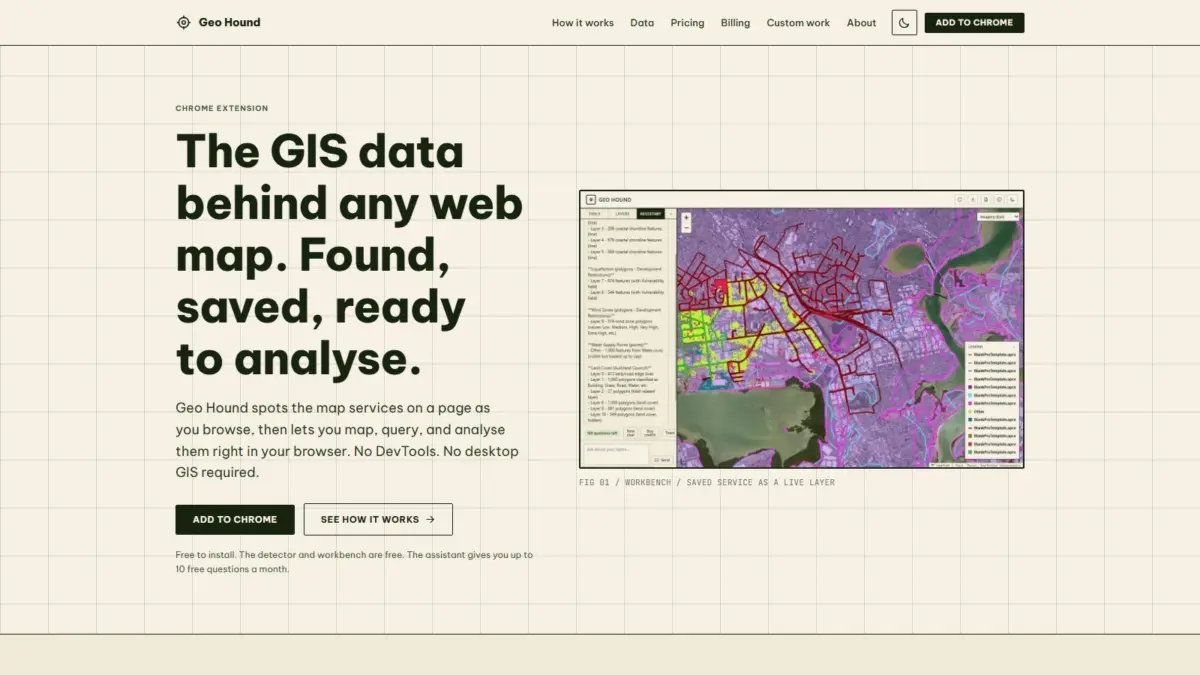
A new tool created by geospatial specialist and podcast host Daniel O’Donohue aims to streamline how spatial data is discovered, captured, and analyzed directly within web browsers. GeoHound, a newly released Google Chrome extension, automatically identifies the backend data services powering interactive web maps as users navigate the web, saving the underlying layers and associated metadata into a unified environment. By eliminating the need to manually dissect browser network requests or load raw endpoints into desktop Geographic Information System (GIS) software, the extension seeks to reduce the operational friction traditionally associated with spatial data extraction.
For years, geographic data hosted on the internet has lived behind front-end web mapping applications. Interactive web maps encountered on news portals, municipal planning sites, environmental dashboards, and corporate portals rely on dynamic connections to remote spatial servers. When a user pans or zooms across a digital map, the underlying web application requests spatial assets from remote endpoints, returning rendering instructions, raster map images, or vector feature payloads.
Historically, geospatial professionals, researchers, spatial analysts, and data journalists who wished to identify or extract those raw data sources were forced to conduct technical network analysis. This manual process—often referred to as inspecting network traffic or DevTools spelunking—required users to open browser developer consoles, monitor incoming web requests, filter through long lists of network activity, isolate specific spatial query parameters, and manually reconstruct service URLs for external use. The multi-step task required a strong technical understanding of web protocols and often presented a barrier to fast data gathering.
GeoHound directly addresses this hurdle by continuously operating in the background of the Google Chrome browser. As a user navigates web pages containing interactive maps, the extension automatically intercepts, analyzes, and identifies the active underlying geospatial web services in real time. In total, GeoHound is capable of recognizing 29 distinct types of spatial data delivery protocols and formats. This detection capability covers a broad spectrum of industry standards, ranging from established Open Geospatial Consortium (OGC) specifications to enterprise vendor formats and web vector files.
Among the detected protocol types are foundational Web Map Services (WMS), which stream server-rendered map images, and Web Feature Services (WFS), which transmit full vector geometries and attribute tables directly to the client interface. The extension also identifies modern OGC API standards, which are increasingly adopted to replace legacy web services with modern RESTful spatial architecture.
In addition to open standards, GeoHound detects proprietary enterprise formats such as Esri ArcGIS REST services, encompassing MapServer and FeatureServer endpoints that power public sector and commercial web mapping infrastructure. The extension similarly captures various web tile services—including raster tiles, vector tiles, and Web Map Tile Services (WMTS)—alongside standalone web vector formats such as GeoJSON payloads embedded within web pages or transmitted via asynchronous web requests.
Beyond identifying active spatial URLs, GeoHound automatically captures and preserves the structured metadata associated with each detected service layer. Spatial datasets rely on metadata to convey context, coordinate reference systems, layer names, feature attributes, and service constraints. By saving this metadata alongside the underlying service endpoints, the extension ensures that users maintain critical operational context when cataloging, inspecting, or reusing web-discovered spatial layers across different projects.
Once layers are detected and cataloged, GeoHound provides an integrated workbench directly inside the web browser to work with the harvested spatial data. Rather than requiring users to copy endpoints, launch desktop GIS applications such as QGIS or Esri ArcGIS Pro, and establish new remote database or web service connections, the built-in workbench allows users to analyze and manipulate spatial datasets immediately within their active web session. This native design bridges the gap between passive web browsing and active spatial data engineering.
Within the browser-native workbench, users can perform core spatial processing and data manipulation tasks on their saved layers. The tool includes functionality for filtering datasets based on specific attribute values or spatial parameters, allowing users to isolate features of interest without altering original backend servers or writing external web queries. Users can also execute spatial buffering operations, creating defined geographic proximity zones around point, line, or polygon geometries directly within the browser memory.
Furthermore, the workbench supports attribute and spatial joins, enabling users to combine separate datasets harvested across different web pages or services into unified spatial layers. Once analysis, joining, or data cleaning is complete, the workbench permits direct data export, allowing users to extract processed datasets out of the browser environment and into standard geospatial formats for long-term storage, sharing, or downstream mapping workflows.
The consolidation of detection, metadata capture, and spatial processing into a single browser extension removes major software dependencies for basic spatial data discovery. Traditionally, inspecting a remote WFS or ArcGIS REST endpoint required translating complex URL parameters and loading layers into software packages designed primarily for heavy cartography and advanced geoprocessing. By executing primary spatial functions within the web browser environment, GeoHound allows analysts to perform rapid triage, exploratory data analysis, and layer validation without leaving the webpage where the data was originally published.
To simplify spatial analytics further, GeoHound integrates an artificial intelligence assistant capable of executing GIS operations through conversational language. Rather than requiring users to construct complex spatial SQL queries, navigate nested toolbar menus, or write custom computational scripts, the AI assistant allows users to run tasks on their saved layers using plain English commands. Users can instruct the assistant to perform operations—such as filtering specific geographic features, calculating buffer zones, or executing spatial comparisons—simply by describing the desired output in natural language text. This capability aims to make spatial operations accessible to users who may lack formal training in GIS software or spatial database administration, while offering experienced specialists a faster method for executing routine workflows.
The core detection functionality and the built-in browser workbench are provided free of charge. The availability of free basic discovery and analytical capabilities ensures that broad segments of the spatial community, including students, journalists, public policy researchers, and open-source enthusiasts, can inspect and evaluate web-based spatial data without software subscription costs or technical overhead. The plain-English AI assistant complements the free core features by offering automated execution of spatial tasks on saved datasets.
GeoHound was developed by Daniel O’Donohue, a geospatial specialist with a professional background centered on using spatial technologies to analyze geographic complexities layer by layer. O’Donohue is widely recognized across the spatial industry as the creator and voice behind The MapScaping Podcast, an established media platform dedicated to highlighting technical developments, spatial engineering methodologies, and industry trends within the geographic information community. His work across podcasting and spatial consultancy frequently focuses on democratizing access to geographic tools, improving data interoperability, and reducing technical barriers in spatial workflows.
The launch of GeoHound reflects an ongoing shift within the geographic information software landscape toward web-first tools, automated data discovery, and natural language interfaces. As public agencies, research institutions, and private enterprises increasingly deploy web maps as their primary medium for geographic data distribution, the sheer volume of spatial endpoints hosted on the public internet continues to grow exponentially. However, discovering, validating, and reusing that underlying data has frequently remained hindered by legacy protocols, siloed web architectures, and heavy software dependencies.
By transforming the standard web browser into an active spatial data detector and processing environment, tools like GeoHound highlight the growing convergence between everyday web browsing and specialized geographic analytical capabilities. As spatial layers continue to proliferate across public and private web applications, automated service detection paired with lightweight, in-browser analysis offers a streamlined approach to interacting with the geographic data that powers the modern web.