Despite remaining offshore, Hurricane Simon delivered a severe blow to Mexico’s Pacific coast, unleashing powerful winds, torrential rainfall, and widespread coastal flooding. While emergency management teams and local authorities scrambled to respond to the unfolding weather crisis on the ground, orbital instruments operated by space agencies managed to document a remarkably rare and scientifically captivating phenomenon. High above the churning vortex of the Category 4 storm, sensitive NASA satellites captured massive, luminous waves rippling through Earth’s upper atmosphere, providing researchers with a unique look at the invisible mechanical forces that massive tropical systems exert on the planet’s atmosphere.
Hurricane Simon formed as part of an active and potent sequence of tropical cyclones sweeping across the Eastern Pacific basin during the 2026 hurricane season. By October 11, 2026, the storm had intensified into a dangerous Category 4 hurricane, tracking on a north-northwest trajectory that brought its formidable circulation frighteningly close to the Mexican coastline. At its peak intensity around this period, the system sustained maximum winds reaching an astonishing 250 kilometers, or approximately 155 miles, per hour.
Hurricane Simon Batters Mexico’s Pacific Coast
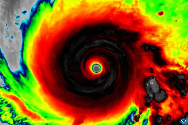
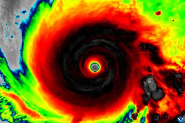
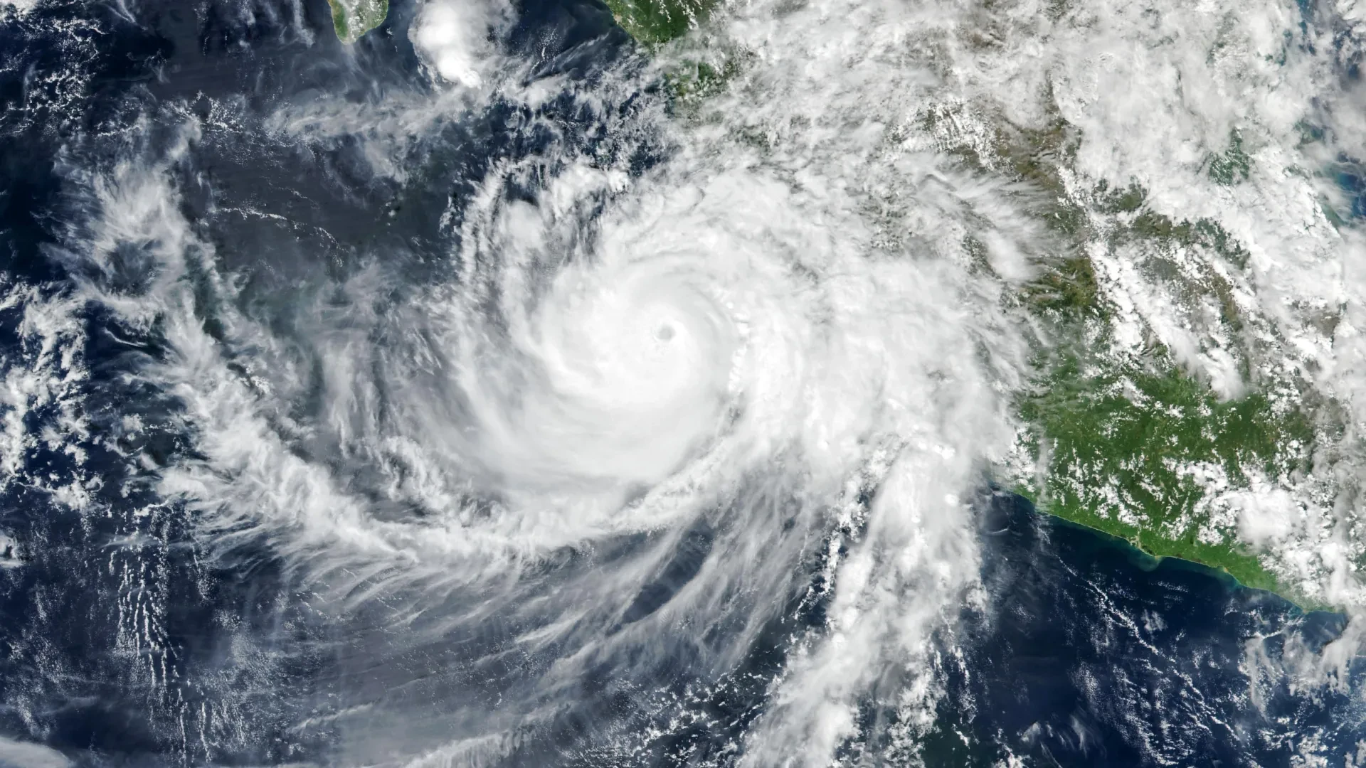
The threat to land became acute on the afternoon of October 11. At approximately 2:30 p.m. local time, corresponding to 20:30 Universal Time, the Visible Infrared Imaging Radiometer Suite instrument aboard the joint NASA and NOAA Suomi National Polar-orbiting Partnership satellite focused its lenses on the massive hurricane. At that precise moment, the eye of Hurricane Simon was positioned roughly 50 kilometers, or about 30 miles, off the mainland coast, wedged tightly between the major coastal urban and port centers of Manzanillo and Puerto Vallarta.
Data analyzed by the National Hurricane Center indicated that sustained winds had marginally decreased to approximately 210 kilometers, or 130 miles, per hour by the time the satellite imagery was acquired. Nevertheless, despite this slight downward trend in peak wind velocity, the hurricane’s inner core remained exceptionally dangerous and perilously close to populated coastal regions, threatening infrastructure, shipping lanes, and residential communities along the shoreline.
As the storm crawled northward, the rugged topography of the Sierra Madre mountain range played a crucial, mitigating role in modifying the system. The towering terrain of the interior acted as a physical barrier that helped limit Simon’s overall strength, successfully reducing the storm’s core intensity and shrinking the spatial footprint affected by its most destructive gale-force winds.
Even with this mountainous intervention softening the blow, the cyclone packed enough atmospheric energy to dump relentless sheets of rain across the coastline. Low-lying areas and coastal settlements, including the vital port city of Manzanillo, quickly succumbed to severe flooding. Furthermore, news reports from the region highlighted that the continuous, heavy precipitation dramatically heightened the threat of catastrophic mudslides and landslides across the steep, saturated slopes of the mountainous interior, prompting emergency evacuations and heightened alerts from civil protection agencies.
NASA Captures Strange Waves Above the Hurricane
While Hurricane Simon churned menacingly across the surface of the Eastern Pacific, orbital monitoring systems detected a breathtaking and otherworldly spectacle unfolding far above the cloud tops, entirely invisible to the naked eye of observers on the ground.
During the early morning hours of October 11, the intense thermal and mechanical energy of the storm generated massive, rippling disturbances that propagated vertically all the way into Earth’s upper atmosphere. A specialized nighttime satellite image, captured by the VIIRS instrument flying aboard the NOAA-21 satellite, successfully documented these atmospheric gravity waves spreading outward in wide, concentric rings originating directly from the footprint of the hurricane below.
These atmospheric undulations are born from violent thermodynamic and physical processes operating within the tempest. Near the churning eyewall of the hurricane, the massive release of latent heat serves as an engine for powerful convection. This process forces vast quantities of warm, moist air to surge violently upward into the troposphere, rapidly building towering cumulonimbus thunderheads.
The sheer velocity of the strong updrafts inside these convective clouds acts like a massive plunger pushing against the layers of air above, disturbing the surrounding stable atmosphere. This mechanical forcing generates waves that propagate upward, breaking into the stratosphere and mesosphere. Unlike ocean waves, which travel horizontally through a liquid medium, atmospheric gravity waves are oscillations of air parcels, where buoyancy and gravity act together as the fundamental restoring forces pushing the air back toward equilibrium.
Why the Rare Atmospheric Ripples Were Visible
Although intense tropical cyclones frequently generate atmospheric gravity waves, capturing visual evidence of them from space remains an exceptional challenge. Under normal atmospheric conditions, strong and chaotic winds howling at high altitudes frequently disrupt, weaken, or entirely disperse these delicate disturbances long before they can ascend into the mesosphere. It is only when they reach these extreme altitudes that they have any chance of becoming visible through an atmospheric phenomenon known as airglow.
Airglow is a faint, natural luminescence produced by chemical reactions among gases high in Earth’s atmosphere, primarily driven by solar ultraviolet radiation interacting with molecules during the day and subsequent recombination at night. When atmospheric gravity waves pass through this luminous layer of the upper atmosphere, they compress and expand the gas density, creating subtle, alternating variations in brightness that reveal the distinctive ripple patterns of the underlying waves.
The day-night band of the VIIRS instrument is specifically engineered to be sensitive enough to detect this extremely faint light emission. However, this high sensitivity comes with a drawback: the sensor also collects reflected moonlight bouncing off Earth’s surface and lower cloud decks, a factor that can easily wash out and obscure the much weaker luminescence of the airglow.
Fortunately for atmospheric scientists, observation conditions aligned in a uniquely favorable configuration when the satellite passed over Hurricane Simon. With lunar illumination at a minimum and very little moonlight reflecting off the planet, the delicate atmospheric ripples stood out with remarkable clarity against the dark background, allowing the satellite to document the striking, wave-like patterns in unprecedented detail.
Hurricane Simon’s Unpredictable Path Raises Concerns
By the morning of October 13, weather forecasters and meteorologists at forecasting centers were still grappling with high levels of uncertainty regarding Simon’s future trajectory and potential intensity. The National Hurricane Center explicitly characterized its confidence in the storm’s intensity and track forecasts as "very low confidence," a clear reflection of how the cyclone had consistently defied standard modeling and behaved in erratic, unexpected ways.
At that stage in the storm’s lifecycle, multiple scenarios remained on the table. One prominent possibility suggested that Simon could eventually execute a northward turn, potentially tracking into the Gulf of California and posing a direct threat of a future landfall along the Mexican mainland.
Regardless of whether the storm ultimately moved ashore or stayed out to sea, its massive spatial reach meant that severe impacts were far from over. Large, powerful ocean swells generated by the persistent hurricane-force winds were forecast to propagate across the region, creating hazardous surf, dangerous rip currents, and coastal erosion along substantial portions of Mexico’s southwestern and west-central coastlines over the ensuing days.
NASA Earth Observatory images by Michala Garrison, utilizing VIIRS data sourced from NASA EOSDIS LANCE, GIBS/Worldview, the Suomi National Polar-orbiting Partnership, and the Joint Polar Satellite System (JPSS).